668 visites | Pública | Neerlandès
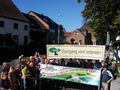
Walk for the Day of the Slow Road, organized by Trage Wegen GENT, with the kind cooperation of the Trage Wegen Zemst.
Would you like an A3 format copy of the neighbourhood road numbering?
ftp.wmin.be/BuurtwegenAtlasZemst/Dag%20van%20de%20Trage%20Weg%2016-10-2016%20Zemst%2C%2025%20trage%20wegen%20over%2012%2C5%20km.jpg
Departure and arrival at the Sint-Martinuskerk in Weerde on 16 October at 13:30h.
The walking loop runs entirely in a counterclockwise direction and is about 12.5 km long; it lies largely around the Senne.
If you want a copy in A3 format: Download it and print on A3 or 2xA4: ftp://wmin.be@ftp.wmin.be/BuurtwegenAtlasZemst/Dag%20van%20de%20Trage%20Weg%2016-10-2016%20Zemst%2C%2025%20trage%20wegen%20over%2012%2C5%20km.%20Trage%20Wgen%20Zemst%20-%20Natuurpunt%20Zemst%20-%20Bruggenbouwers%20Zemst.jpg
The nice thing about this walk is also the amount of foot and neighborhood roads that are located in Weerde: Weerde is the borough in Zemst with the largest number of slow roads in Zemst.
Following the Senne takes place in 3 phases:
1. Partly the concrete Senne is followed, partly the natural meandeers, and also partly the old Senne bed (Nature Area Dorent-Nelebroek)
At the same time, some important slow roads are being taken that are not currently set up as such, and are therefore partly unknown, taken or plowed at the Zemstenaar. For example, we are talking about this (in a contradictory sense). The route follows these Atlas roads in its entirety. You can copy a printout in Routeyou, or use this reference to see the Atlas of Local Roads over which the walk is placed. That way you can see if you are following an Atlas road or not.
CH 4: the Plasstraat;
CH 60: the Weerdemolenvoetweg;
CH 61: the Zennebrugvoetweg
CH 53: the Neckhalsvoetweg;
CH 54: the Kasteelbuurtweg
CH 59: the Hooyvetters neighbourhood road
A layout of the walk on top of the ATLAS MAP OF LOCAL ROADS is still published here:
ftp://wmin.be@ftp.wmin.be/BuurtwegenAtlasZemst/Dag%20van%20de%20Trage%20Weg%2016-10-2016%20Zemst%2C%2025%20trage%20wegen%20over%2012%2C5%20km.%20Trage%20Wgen%20Zemst%20-%20Natuurpunt%20Zemst%20-%20Bruggenbouwers%20Zemst.jpg
Navega per la ruta a...
![]() Aplicació RouteYou Obriu
Aplicació RouteYou Obriu
Deixar de veure aquest anunci?
→ Millorar ara
![]()
Espereu, s'està preparant la navegació.
Ara pots navegar. Diverteix-te a la carretera!
Processament de la sol·licitud ha fracassat. Si us plau, torneu a intentar.
Deixar de veure aquest anunci?
→ Millorar ara
![]()
Espereu, s'està preparant la teva descàrrega.
La teva descàrrega està llesta. Diverteix-te a la carretera!
Processament de la sol·licitud ha fracassat. Si us plau, torneu a intentar.
Deixar de veure aquest anunci?
→ Millorar ara
![]()
Espereu, s'està preparant la teva impressió.
La teva impressió està llesta per descarregar. Diverteix-te a la carretera!
Processament de la sol·licitud ha fracassat. Si us plau, torneu a intentar.
Deixar de veure aquest anunci?
→ Millorar ara
![]()
Espereu, s'està preparant la teva descàrrega.
La teva descàrrega està llesta. Diverteix-te a la carretera!
Processament de la sol·licitud ha fracassat. Si us plau, torneu a intentar.
<iframe src="https://plugin.routeyou.com/routeviewer/free/?language=ca&params.route.id=4503252&params.language=en" width="100%" height="600" frameborder="0" allowfullscreen></iframe>
<a href="https://www.routeyou.com/en-be/route/view/4503252/walking-route/day-of-the-slow-road-16-10-2016-12-5km?utm_source=embed&utm_medium=article&utm_campaign=routeshare" title="Day of the Slow Road 16-10-2016 (12,5km) - RouteYou" target="_blank"><img src="https://image.routeyou.com/embed/route/960x670/4503252-en@2x.png" width="960" height="670" alt="Day of the Slow Road 16-10-2016 (12,5km)"></a>
Feedback adicional:
Proveu aquesta funcionalitat gratuïtament amb una subscripció de prova RouteYou Plus.
Si ja disposa d'aquest compte, connecteu ara.
Proveu aquesta funcionalitat gratuïtament amb una subscripció de prova RouteYou Premium.
© 2006-2024 RouteYou - www.routeyou.com