Bron: Groenplan Stad Antwerpen
Auteursrechten: All rights reserved
2316 keer bekeken | Publiek | Nederlands
Starting location
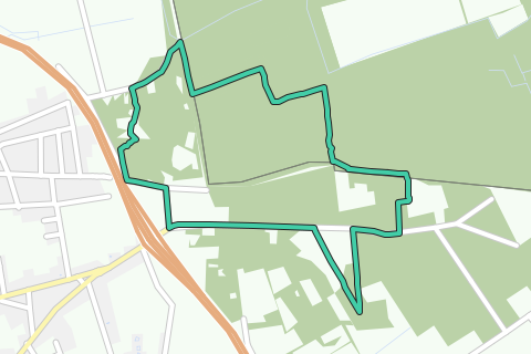
Rugged Heath, near the A12 underpass
Accessible with:
Bus 671, 770, 771, 772, 778, 779, 780
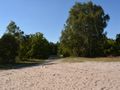
Landscape
This landscape is closely related to the sandy Kempen and has a much more rural character than the other area around Antwerp. The Heideland is isolated from the buildings. The A12 forms a hard barrier that cuts this area off from the rest of the city. This landscape is unique in Antwerp. Nowhere in the city is the heath and forest habitat still so intact. The Antwerp zone is in line with the valuable cross-border Natura 2000 area 'Zoom-Kalmthoutse Heide', which includes both extensive Birds Directive and Habitats Directive areas.
Navigeer de route met...
![]() RouteYou app Open
RouteYou app Open
![]()
Even geduld, je afdruk wordt voorbereid.
Je afdruk is klaar om te downloaden. Veel plezier onderweg!
Het verwerken van de aanvraag is mislukt. Gelieve het opnieuw te proberen.
<iframe src="https://plugin.routeyou.com/routeviewer/free/?language=nl&params.route.id=4425124&params.language=en" width="100%" height="600" frameborder="0" allowfullscreen></iframe>
<a href="https://www.routeyou.com/en-be/route/view/4425124/hiking-route/northern-heideland-green-plan-walk-antwerp?utm_source=embed&utm_medium=article&utm_campaign=routeshare" title="Northern heideland - Green plan walk Antwerp - RouteYou" target="_blank"><img src="https://image.routeyou.com/embed/route/960x670/4425124-en@2x.png" width="960" height="670" alt="Northern heideland - Green plan walk Antwerp"></a>
Bijkomende feedback:
Probeer deze functionaliteit gratis met een RouteYou Plus-proefabonnement.
Als je al een dergelijke account hebt, meld je dan nu aan.
Probeer deze functionaliteit gratis met een RouteYou Premium-proefabonnement.
Als je al een dergelijke account hebt, meld je dan nu aan.
© 2006-2024 RouteYou - www.routeyou.com