Bron: Trougnouf (Benoit Brummer)
Auteursrechten: Creative Commons 4.0
5697 keer bekeken | Publiek | Frans • Nederlands
The true authentic Ardennes cover much of southern Belgium, but not the entire region south of the Sambre and Meuse valleys, as is sometimes heard. The southern border of the Ardennes follows the Muno-Florenville-Nothomb line. On the other side is Belgian Lorraine, home to the Attert Valley Nature Park. This park includes 17 villages and hamlets and rises on average 330 m above sea level, between the wooded massif of Anier (north) and the first cuesta (chain of hills) of Belgian Lorraine (south). The park is extremely rich in natural beauty, but also in architectural heritage: farms, houses, chapels, calvaries, etc.
DISTANCE
8.5 km.
TYPE OF ROAD
The first third of the boardwalk offers only asphalt roads, with the exception of a small stretch of campway with base surface. The second third follows a forest road, mostly with base coating but bitumined when it approaches the village of Thiaumont. The last part is just asphalt roads. The slopes on the border of the Ardennes and the Natural Park of the Attert Valley are not very steep: you will never be out of breath. But the condition of the country road with base lining at the beginning and that of the forest road in the middle is not suitable for strollers and wheelchairs. You can at most bring a light stroller, but only in dry periods.
MARKUP
None, except for a little signage with green diamonds lying in Thiaumont, but it has no importance for the route. A few signposts or street signs may be helpful.
PARKING
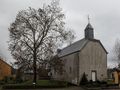
You will certainly find a place to park the car for a long time in the immediate vicinity of the yellow church of Nobressart.
TOPOGRAPHIC MAPS
IGN 68/3-4 and 68/7-8.
INFORMATION
Tourist Office of Val d'Attert, Voie de la Liberté 107, 6717 Attert
Tel. 063 22 26 17
Fax 063 21 67 75
E-mail: si.attert@skynet.be
Internet: www.arlon-tourisme.be
Navigeer de route met...
![]() RouteYou app Open
RouteYou app Open
Deze advertentie niet meer zien?
→ Upgrade nu
![]()
Even geduld, de navigatie wordt voorbereid.
Je kan nu navigeren. Veel plezier onderweg!
Het verwerken van de aanvraag is mislukt. Gelieve het opnieuw te proberen.
Deze advertentie niet meer zien?
→ Upgrade nu
![]()
Even geduld, je download wordt voorbereid.
Je download is klaar. Veel plezier onderweg!
Het verwerken van de aanvraag is mislukt. Gelieve het opnieuw te proberen.
Deze advertentie niet meer zien?
→ Upgrade nu
![]()
Even geduld, je afdruk wordt voorbereid.
Je afdruk is klaar om te downloaden. Veel plezier onderweg!
Het verwerken van de aanvraag is mislukt. Gelieve het opnieuw te proberen.
<iframe src="https://plugin.routeyou.com/routeviewer/free/?language=nl&params.route.id=1156&params.language=en" width="100%" height="600" frameborder="0" allowfullscreen></iframe>
<a href="https://www.routeyou.com/en-be/route/view/1156/walking-route/nobressart?utm_source=embed&utm_medium=article&utm_campaign=routeshare" title="Nobressart - RouteYou" target="_blank"><img src="https://image.routeyou.com/embed/route/960x670/1156-en@2x.png" width="960" height="670" alt="Nobressart"></a>
Bijkomende feedback:
Probeer deze functionaliteit gratis met een RouteYou Plus-proefabonnement.
Als je al een dergelijke account hebt, meld je dan nu aan.
Probeer deze functionaliteit gratis met een RouteYou Premium-proefabonnement.
Als je al een dergelijke account hebt, meld je dan nu aan.
© 2006-2024 RouteYou - www.routeyou.com
