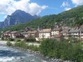
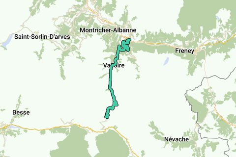
Climb to the Col de Galibier from Saint Michel de Maurienne, via Col de Télégraphe. The climb gets you to a height of 2642m over a length of about 35 km. The height difference from the start is 1933m. The average slope is 5.48% with max. slopes of 15%. The col is open from June till October.
Naviga nel percorso in...
![]() App RouteYou Aprire
App RouteYou Aprire
![]()
Attendi, la tua stampa è in preparazione.
La tua stampa è pronta per il download. Buon divertimento in viaggio!
Elaborazione della richiesta non è riuscita. Si prega di riprovare.
<iframe src="https://plugin.routeyou.com/routeviewer/free/?language=it&params.route.id=2005972&params.language=en" width="100%" height="600" frameborder="0" allowfullscreen></iframe>
<a href="https://www.routeyou.com/en-fr/route/view/2005972/road-bike-route/col-du-galibier-from-st-michel-de-mairienne?utm_source=embed&utm_medium=article&utm_campaign=routeshare" title="Col du Galibier from St.Michel de Mairienne - RouteYou" target="_blank"><img src="https://image.routeyou.com/embed/route/960x670/2005972-en@2x.png" width="960" height="670" alt="Col du Galibier from St.Michel de Mairienne"></a>
Altri commenti:
Prova questa funzionalità gratuitamente con un abbonamento di prova RouteYou Plus.
Se hai già un tale account, accedi ora.
Prova questa funzionalità gratuitamente con un abbonamento di prova RouteYou Premium.
Se hai già un tale account, accedi ora.
© 2006-2024 RouteYou - www.routeyou.com