263 visitas | Pública
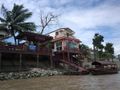
This kayak track is designed to bring you around Ayutthaya's city island. Ayutthaya was typically a Siamese water-based settlement, one of the characteristics which gave the city its UNESCO World Heritage status. Unfortunately, Ayutthaya's waterways - the ancient transport and travel facilities - are fast disappearing. Many canals became stagnant, choked with urban trash or ran dry due to silting and lack of maintenance. Many more were claimed to make way for embankments, such as concrete roads. Ayutthaya, "The Venice of the East", became a far cry. Notwithstanding, a tour around the island is still a wonderful event.
In the Ayutthayan era, it was the Lopburi River which encircled the city. The Chao Phraya River was diverted to Ayutthaya in 1857, while the Pa Sak River or Teak Forest River finding its source in Loei Province, changed its course at the beginning of the last century when the river course was straightened.
The Chao Phraya in Ayutthaya is a tidal river and influences the Pa Sak and Lopburi rivers. The current shifts daily, depending on the tide in the Gulf of Thailand, with an exception at the end of the rainy season when the floodwaters overrun the tide.
The tour (clockwise) takes you north along the Chao Phraya River, which was until the mid-19th century still the river bed of the Lopburi River; turns at Hua Laem into Khlong Mueang also called the City Canal and a former stretch of the Lopburi River; curving south at Hua Ro on a waterway which was once a part of the front city moat, dug for defensive purposes and leaping into the Pa Sak River; arriving at Hua Sarapha in front of Wat Phanan Choeng and the major confluence of the Chao Phraya and Pa Sak Rivers near Phet Fortress, steer up north to the arrival point opposite Wat Phutthai Sawan.
Tips and Warnings
Ayutthaya, although located far away from the Gulf of Thailand, is still under tidal influence. The Chao Phraya River and Pa Sak River at Ayutthaya are thus tidal rivers, causing the waterways to shift direction once a day. The tidal action is predictable. A tidal table of Bangkok can be found at https://www.tide-forecast.com/locations/Bangkok-Thailand/tides/latest (add 7 hours to the Bangkok local time). It may be useful to adjust your itinerary in the function of these shifting currents and do some of the kayaking routes in reverse if missing stamina.
Be aware of the whirlpools and heavy current between Ko Loi – Ayutthaya Boat Building School and the eastern Pa Sak River Bank and at the confluence of the Pa Sak and Chao Phraya River in front of Phet Fortress, especially during the second part of the rainy season (September - November). In normal months, stick close to the eastern Pa Sak River bank; From September to November, stick to the western bank. Wear a life jacket and hook up your equipment!
Protect you from sunshine. Wear a hat, sunglasses and loose-fitting clothing that covers arms and legs. Use a sun blocker on exposed parts of the body. It is important to bring a large bottle of water aboard.
On the water, exercise caution!
Who are we?
Ayutthaya Historical Research [AHR] consists of a small group of researchers/writers with the aim of promoting Ayutthaya’s cultural heritage. We are local expatriates who have been living in Ayutthaya for many years and would like to share our knowledge with future visitors. More information on the authors can be found at: http://www.ayutthaya-history.com/Authors.html
In an emergency or accident:
Contact the Ayutthaya Tourist Police Station: (035) 241-446; (035) 242-352 or 1155.
Disclaimer
AHR will not be held liable for any loss or damage whatsoever for any suggestions made in relation to the site’s promotion of ecotourism. It is the responsibility of the user of the site to take the necessary precautions to avoid any physical injury, traffic incident, animal attack, theft, or damage to equipment. Any reliance on the site’s information is, therefore strictly at your own risk. Read our full disclaimer at the website www.ayutthaya-history.com.
POI Markings:
Historical signboard in situ is marked as (*)
Entry fee required is marked as ($)
Boat dock present is marked as (+)
©2010-2023 Ayutthaya Kayaking Experience
All rights reserved.
Fuente: Ayutthaya Kayaking Experience
Navegar ruta en...
![]() Aplicación RouteYou Abre
Aplicación RouteYou Abre
¿No quieres ver más este anuncio?
→ Mejorar ahora
![]()
Espere, se está preparando la navegación.
Ahora puede navegar. ¡Diviértete en el camino!
El procesamiento de la solicitud ha fracasado. Por favor, inténtelo de nuevo.
¿No quieres ver más este anuncio?
→ Mejorar ahora
![]()
Espere, se está preparando su descarga.
Su descarga esta lista. ¡Diviértete en el camino!
El procesamiento de la solicitud ha fracasado. Por favor, inténtelo de nuevo.
¿No quieres ver más este anuncio?
→ Mejorar ahora
![]()
Espere, se está preparando su impresión.
Su impresión está lista para descargarse. ¡Diviértete en el camino!
El procesamiento de la solicitud ha fracasado. Por favor, inténtelo de nuevo.
<iframe src="https://plugin.routeyou.com/routeviewer/free/?language=es&params.route.id=445260&params.language=en" width="100%" height="600" frameborder="0" allowfullscreen></iframe>
<a href="https://www.routeyou.com/en-th/route/view/445260/canoe-kayak-route/ayutthaya-city-island-kayak-track?utm_source=embed&utm_medium=article&utm_campaign=routeshare" title="Ayutthaya - City Island Kayak Track - RouteYou" target="_blank"><img src="https://image.routeyou.com/embed/route/960x670/445260-en@2x.png" width="960" height="670" alt="Ayutthaya - City Island Kayak Track"></a>
Comentarios adicionales:
Pruebe esta funcionalidad gratis con una suscripción de prueba RouteYou Plus.
Si ya dispone de dicha cuenta, conectarse ahora.
Pruebe esta funcionalidad gratis con una suscripción de prueba RouteYou Premium.
Si ya dispone de dicha cuenta, conectarse ahora.
© 2006-2024 RouteYou - www.routeyou.com