Copyright: Creative Commons 3.0
175 views | Public
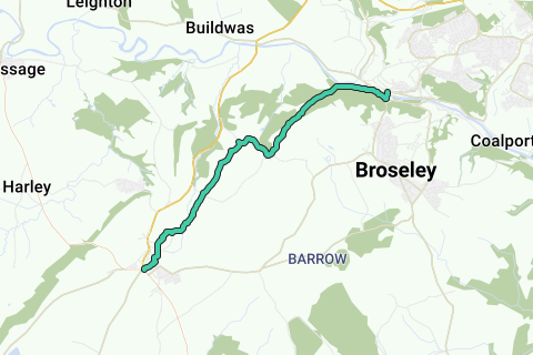
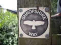
The Shropshire Way is a waymarked long distance footpath running through the English county of Shropshire. It runs 224 kilometres (139 mi) around the interior of the county in a large loop.
More info on Wikipedia Wikipedia and Openstreetmap.
Inspired by OSM.
Roads 
Appropriateness as Hiking route: 

Paved:  (7.67% - 1 km unpaved)
Traffic load:  (low traffic)
Noise pollution: 
Landscape Characteristics
Nature landscape: 
Urbanized area: 
Near water: 
Dominant direction( )
)  :15% :52%
  :23%
:23%
Above analysis can contain errors because of missing or incomplete information in our database. Help us improve the score of this route by answering the questions on following link.
Navigate route in...
![]() RouteYou app Open
RouteYou app Open
Don't want to see this ad anymore?
→ Upgrade now
![]()
Please wait, the navigation is being prepared.
You can now navigate. Have fun on the road!
Processing your request has failed. Please try again.
Don't want to see this ad anymore?
→ Upgrade now
![]()
Please wait, your download is being prepared.
Your download is ready. Have fun on the road!
Processing your request has failed. Please try again.
Don't want to see this ad anymore?
→ Upgrade now
![]()
Please wait, your print is being prepared.
Your print is ready to download. Have fun on the road!
Processing your request has failed. Please try again.
<iframe src="https://plugin.routeyou.com/routeviewer/free/?language=en&params.route.id=4386472" width="100%" height="600" frameborder="0" allowfullscreen></iframe>
<a href="https://www.routeyou.com/en-gb/route/view/4386472/hiking-route/shropshire-way-route-13-much-wenlock-to-benthall-edge?utm_source=embed&utm_medium=article&utm_campaign=routeshare" title="Shropshire Way (Route 13. Much Wenlock to Benthall Edge) - RouteYou" target="_blank"><img src="https://image.routeyou.com/embed/route/960x670/4386472-en@2x.png" width="960" height="670" alt="Shropshire Way (Route 13. Much Wenlock to Benthall Edge)"></a>
Additional feedback:
Try this feature for free with a RouteYou Plus trial subscription.
If you already have such an account, then log in now.
Try this feature for free with a RouteYou Premium trial subscription.
If you already have such an account, then log in now.
© 2006-2024 RouteYou - www.routeyou.com