1170 Aufrufe | Öffentlich | Niederländisch
This is the outer loop that is first addressed in the '3 loops in Drie Fonteinen' (10km) in the route list of 'Vilvoorde soprtief'; It is about 3.8 km long and runs clockwise.
The departure and arrival point is located on the southern corner of the athletics/voutball stand with the parking lot against the Zeekanaal, just south of the Vredesbrug.
It is suitable for walkers, runners and cyclists. Cycling remark: get off after 400m and go up about 90 steps; and after the double crossing under the Great Ring carefully drive down a few wooden steps. For the rest, the route is easily doable by bike.
Typical sights along the way are (click on the POIs in the enlarged map): Old Hollow Roads, old (dilapidated) gatehouses, box crossing under the Great Ring, observation of the Great Ring along the bottom (you get a fairytale spectacle on the curved Ring and bridge levelers. In the past, this was a very daring piece of civil engineering (longest crooked crossing. See http://wegen-routes.be/doss/R0n.html, http://www.deredactie.be/cm/vrtnieuws/mediatheek/programmas/journaal/2.16030/2.16031/1.1042608, and http://www.wegenenverkeer.be/over-awv/multimedia.html). Also a
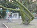
water pond that opens through a crater onto a pond at the Blood Caves, beautiful old trees, low-lying ponds and various sports fields.
Route: This loop starts with a wide lap around the athletics track (first walk until just before the exit of the parking lot, then left, and then keep the path on the right) and takes the stair road on its north side of the athletics track (fenced: this is the first right on the crossroads at the low buildings. We then pass higher tennis courts and football field and then take the higher exit at the district 'De Kassei' west of the Vredesbrug. We follow this exit until just past the buildings on the first transverse street; there left into the forest. This narrow path becomes a bit wider and deeper under the surrounding tree zone: We are in the old hollow roads at the edge of the domain (paved - cobblestone - asfant - earth road). The first Holle Weg (Oude Steenweg on Koningsloo) takes you past some dilapidated gatehouses. A little further you have to turn left (Holle weg Blaesenberg) of which the first part is occupied by one-way car traffic (beware). A little further it is traffic-free again. This Hollow Road then briefly rises to forest height (crosses the northern entrance road to the domain there), and then dives back into the depths. We come under a pedestrian bridge and descend further to the Ring around Brussels (this last part to the Ring can be dirty in the wet season). It protrudes through an unlit tube under the Ring around Brussels (enough light to walk safely through it (asphalt)). Behind the crazier, take a left and follow the Ring on the Brussels side towards Zeekanaal (first some ascent, then down via an asphalt road). The viaduct also starts from the asphalt road, which is supported by ever higher bridge levelers. Follow this road (with its impressive panorama of the supporting structure of the large bend in the Ring) until just past the first two three-lane-wide bridge levelers, behind which you turn left back under the Ring (under the Ring it is uphill). This is past a dead-end paved exit on the left and over a bridge over a narrow pond that lies on the left under the Ring in an increasingly deep gorge. Keep this puddle and gorge on your left until you have reached the other end of this gorge: First this is on an unpaved path (watch out for some wooden steps downhill along the gorge), then paved, and then you come across an old asphalt road (which ran through the domain, but is now interrupted halfway) that you take a left up.
At the lake on the left, notice a beautiful two-deck water crossing. The lower water crossing (just above the water soiegel) is known in the region as the 'Blood Caves'. According to legend, traces of blood from disappeared people have reportedly been found there. For children this is a nice hiding place. However, we leave the bridge on top of these Blood Caves. When we reach the end of the water on the other side of the blood caves, we leave the steep asphalt road and take the forest path along the gardens of the Lenterik district.
This forest path leads to a paved path that we take on the right and keep right along the lowest ponds in the domain.
At the end of these ponds we arrive at the buildings of a (covered) tennis court, which we keep on our left (so stay between these buildings and the Brusselsesteenweg on the Zeekanaal). Behind these buildings is a narrow exit (a few steps) to the parking zone where the starting point of the loop is located.
Although this park zone is located on the Zeekanaal and the Senne, the paths are regularly sloping: on this side of the canal begins the Heuvelland of 'Grim mountains', and you will have known: You have to take into account a height difference of about 52m per loop.
The park zone between the forests is largely laid out in English landscape style, so you can enjoy spacious views between the forests over grass squares and bomb avenues. The largest of these tree avenues ended in the north view on a (now no longer existing) castle, where the VTM is currently located.
You can find more about the History of this domain here: http://www.vilvoorde.be/product.aspx?id=673
Did you know, for example, that on the south side of this Park there used to be a lock complex for the ships on the Zeekanaal (then the Willebroeksevaart)? (http://nl.wikipedia.org/wiki/Zeekanaal_Brussel-Schelde , and http://www.brussel.be/artdet.cfm/7508 )).
Route navigieren in...
![]() RouteYou-App Öffnen
RouteYou-App Öffnen
Diese Werbung nicht mehr anzeigen?
→ Jetzt upgraden
![]()
Bitte warten Sie, die Navigation wird vorbereitet.
Sie können jetzt navigieren. Viel Routen-Spaß!
Bearbeitung Ihrer Anfrage ist fehlgeschlagen. Bitte versuchen Sie es erneut.
Diese Werbung nicht mehr anzeigen?
→ Jetzt upgraden
![]()
Bitte warten Sie, Ihr Download wird vorbereitet.
Ihr Download ist fertig. Viel Routen-Spaß!
Bearbeitung Ihrer Anfrage ist fehlgeschlagen. Bitte versuchen Sie es erneut.
Diese Werbung nicht mehr anzeigen?
→ Jetzt upgraden
![]()
Bitte warten Sie, Ihr Ausdruck wird vorbereitet.
Ihr Ausdruck ist bereit für den Download. Viel Routen-Spaß!
Bearbeitung Ihrer Anfrage ist fehlgeschlagen. Bitte versuchen Sie es erneut.
Diese Werbung nicht mehr anzeigen?
→ Jetzt upgraden
![]()
Bitte warten Sie, Ihr Download wird vorbereitet.
Ihr Download ist fertig. Viel Routen-Spaß!
Bearbeitung Ihrer Anfrage ist fehlgeschlagen. Bitte versuchen Sie es erneut.
<iframe src="https://plugin.routeyou.com/routeviewer/free/?language=de&params.route.id=612249&params.language=en" width="100%" height="600" frameborder="0" allowfullscreen></iframe>
<a href="https://www.routeyou.com/en-be/route/view/612249/jogging-route/3-loops-in-three-fountains-outdoor-loop-3-8km?utm_source=embed&utm_medium=article&utm_campaign=routeshare" title="3 loops in Three Fountains, outdoor loop (3,8km) - RouteYou" target="_blank"><img src="https://image.routeyou.com/embed/route/960x670/612249-en@2x.png" width="960" height="670" alt="3 loops in Three Fountains, outdoor loop (3,8km)"></a>
Zusätzliches Feedback:
Probieren Sie diese Funktionalität kostenlos mit einem RouteYou Plus-Probeabonnement.
Wenn Sie bereits ein solches Konto haben, melden Sie sich jetzt an.
Probieren Sie diese Funktionalität kostenlos mit einem RouteYou Premium-Probeabonnement.
Wenn Sie bereits ein solches Konto haben, melden Sie sich jetzt an.
© 2006-2024 RouteYou - www.routeyou.com